MGS Solutions
MGS has a history of providing geomatics solutions for clients involved in archaeological research, environmental science research, traditional knowledge gathering, site design, community planning, infrastructure planning and target marketing projects.
MGS also has provided data solutions for clients such as event registration systems, member registries, project management systems, customized web sites as well as custom GIS planning and design. Check out our list of solutions below for more information on how MGS can assist you today.
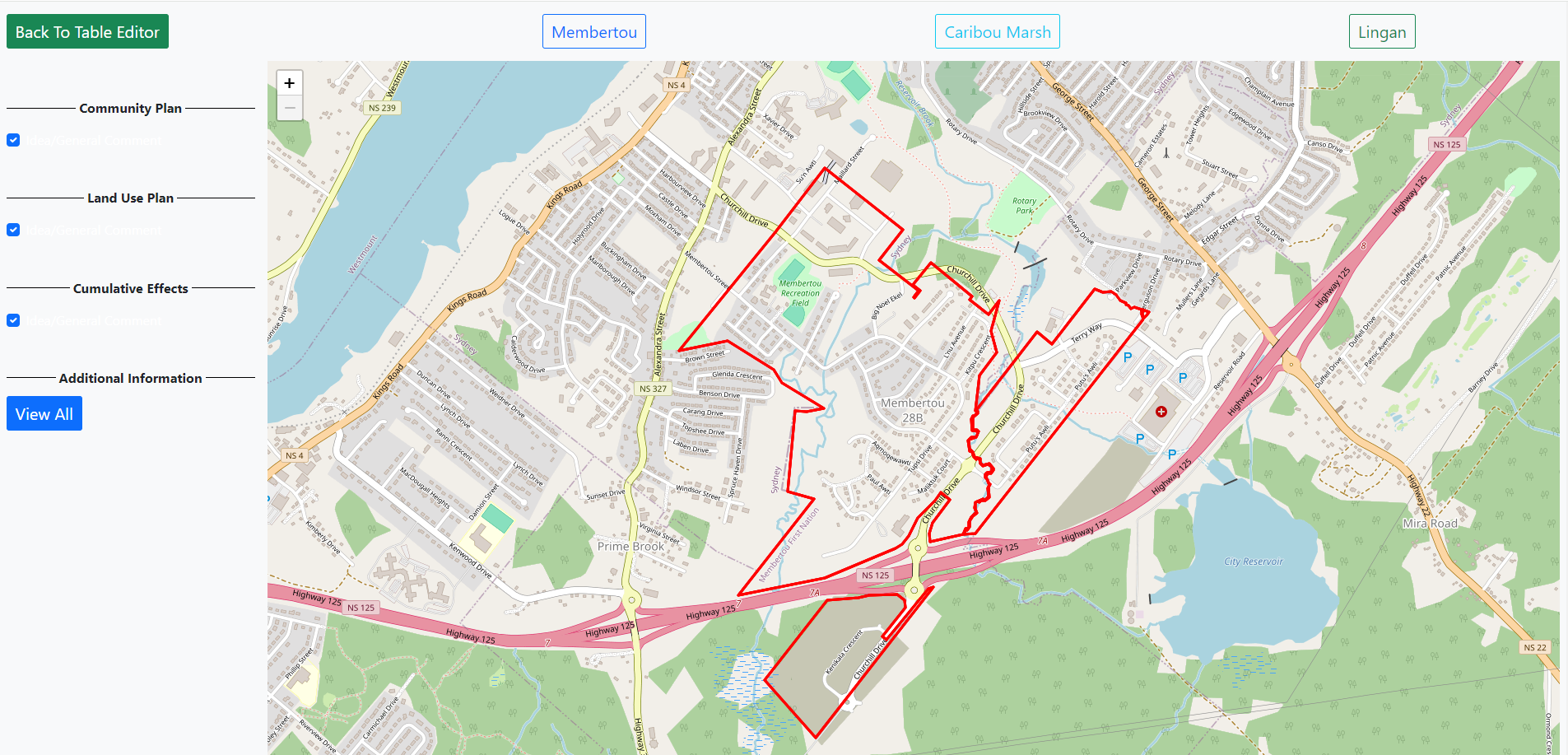
Web-Based GIS
In order to get the most out of GIS data, it has to be accessible. Having the GIS data available via the web allows it to be accessed at any time and any place using common standard web browsers. Custom web development allows the web-based GIS system to provide speci fic solutions.
There are a multitude of GIS applications that can address economic, environmental and cultural issues. Everything from long-term land development plans and site designs, to delivery of services such as emergency health care and infrastructure repairs can be enhanced with clearer information from GIS sources.
Some of the advantages of web-based GIS include:
- The GIS data is in a dynamic map format and can be included in various presentations and reports.
- The web-based GIS can incorporate other data sources, including non-spatial data, in order to present the most useful and relevant information.
- Ability to interact with the application simultaneously, allowing coordinated work to be done.
- GIS data is derived from data residing on networked GIS systems, so the web-based GIS can act as an extension of these.
- Web-based GIS data is in one convenient central location, it is continually backed up, so no data can be lost.
For example, an organization overseeing natural resources has collected data on species habitat. To organize and present this data in order to make better informed decisions regarding the management of this resource, the secure web-based GIS solution brings together data on the study area including satellite imagery, digital elevation models, hydrography, and all pertinent human settlement and road data.
There are many other advantages of having a web-based GIS site, including:
- MGS provides custom development of versatile data-driven web applications. For example: project tracking, client requests, event registration, etc.
- Video and other multimedia can be accessed for a more informative and dynamic experience.
- Projects can be managed via the web so project teams are updated in real time.
- The web applications can provide valuable reporting and statistical analysis.
- Web-based GIS can be customized with client branding.
- MGS provides several options on hosting and maintenance of the data.
Project Management
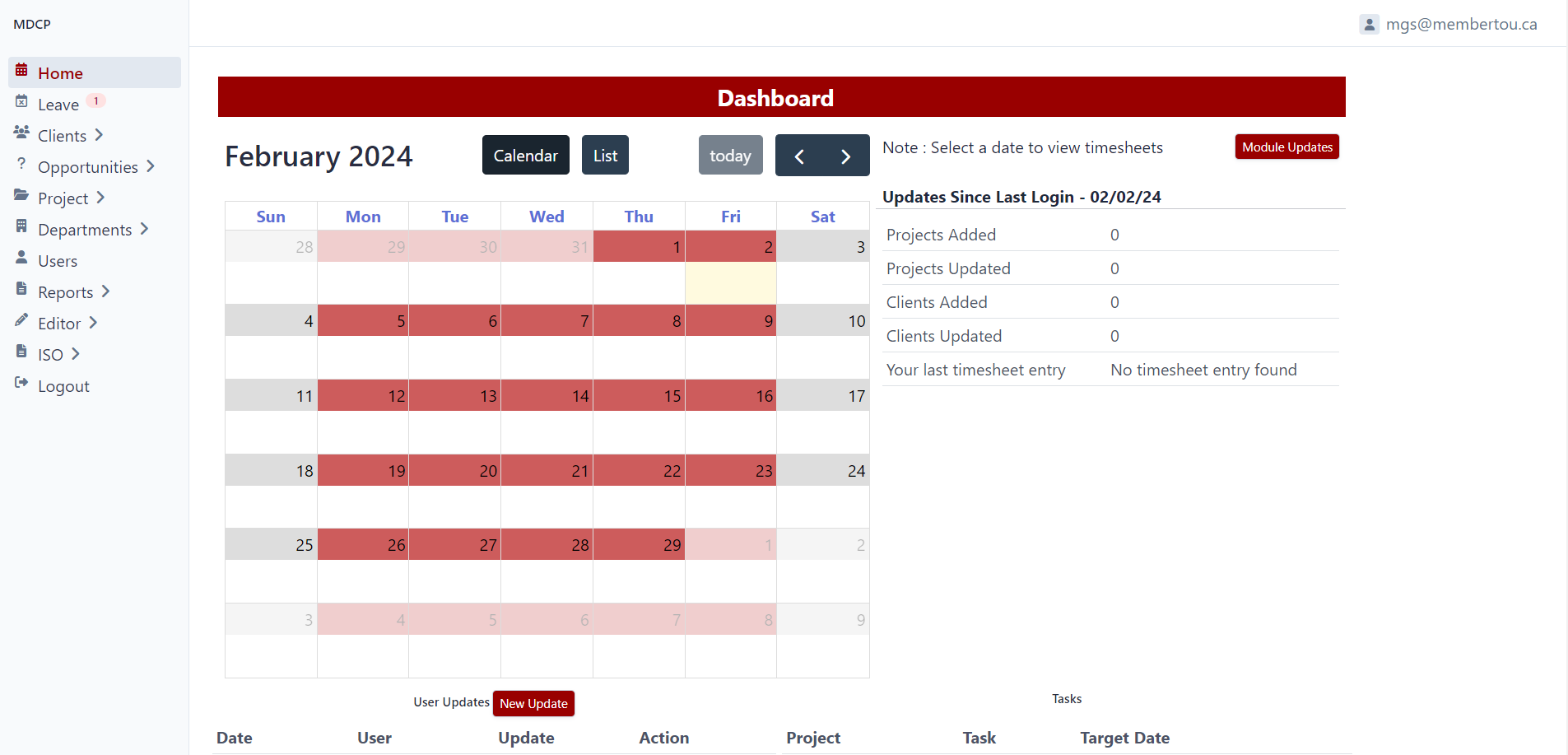
Inspired by the necessity of maintaining our ISO accreditation, MGS has developed project management tools to assist in tracking individual projects, company expenses, employee time, client billing, data sharing as well as monitoring opportunities and planning employee individual work tasks. All of these project management features are accessible via web browsers or network systems and are exported to customized reports depending on client requirements.
The project management features are also customizable to individual client needs such as individual project tracking and reporting to assisting in management of a large organization's daily operations.
Web Applications
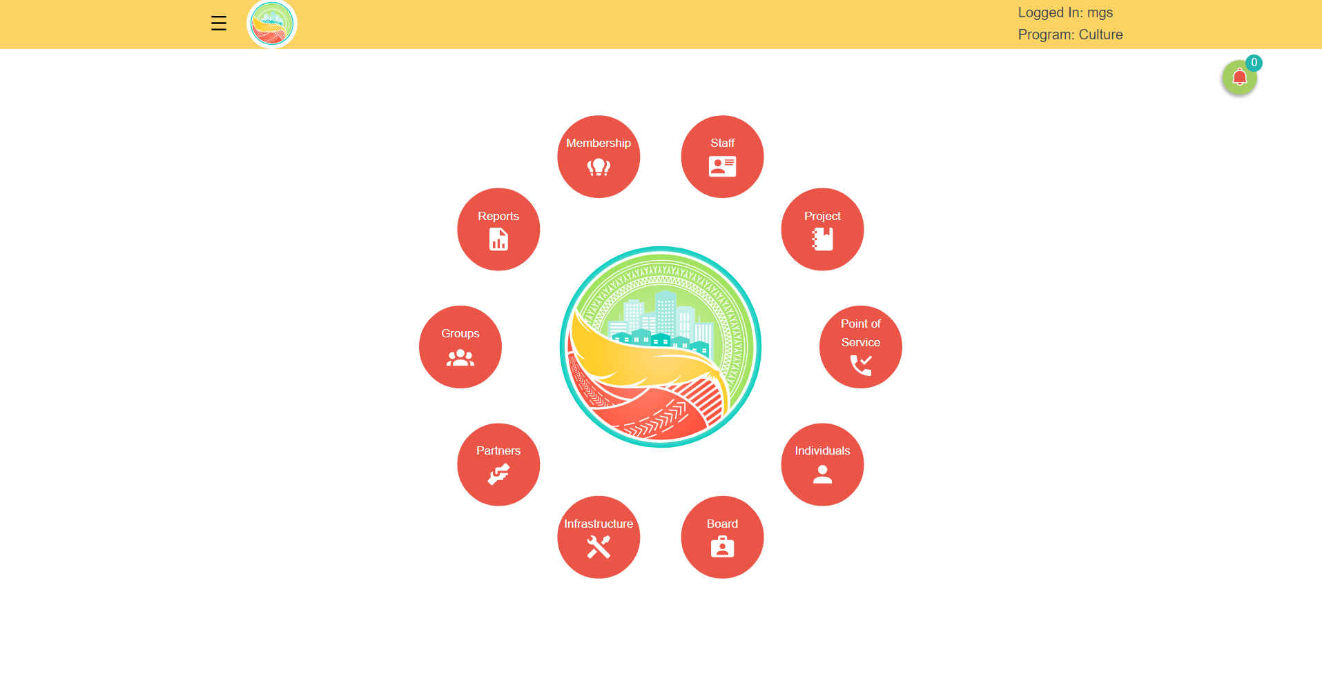
Membertou Geomatics Solutions can develop unique Web Applications to suit a clients' particular needs. Online surveys and/or data input are a typical requirement where clients require input from target audiences or clients to populate a database for further analysis. The resulting data shares the same tracking and reporting functionality of our Project Management tools with additional graph output functionality customized to the clients' needs.
Other examples of online input Web Applications include questionnaires, customer/attendance head counts, event registrations, field sampling and observations as well as maintenance schedules and logs. Web Applications can also be tied directly into the Project Management tracking and reporting system where client online service requests initiate a service ticket, tracking and invoicing process.
Custom Websites
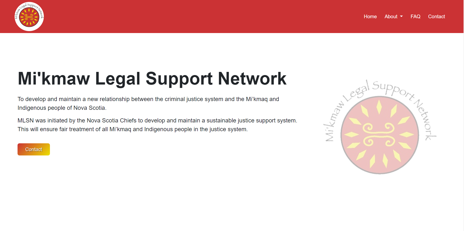
As an extension to our Project Management and Web Application services, Membertou Geomatics Solutions also offers Custom Website design. It was a natural progression for our team to acquire the necessary programming skills to produce functional interfaces for our Web Applications and Project Management services.
MGS also has access to Graphic Designers to utilize their experience in colours, textual copy, fonts, graphics and imagery to more effectively reach our clients' target audiences and assist to fulfill our clients' web presence objectives.